
Make a donation
Gear up for your next adventure:
As an Amazon Associate, this site earns from qualifying purchases at no extra cost to you.
Friendship Park topographic map
Click on the map to display elevation.
Make a donation
Gear up for your next adventure:
As an Amazon Associate, this site earns from qualifying purchases at no extra cost to you.
About this map
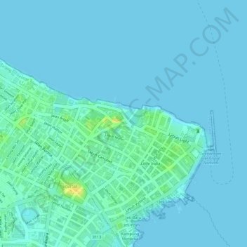
Name: Friendship Park topographic map, elevation, terrain.
Average elevation: 4 m
Minimum elevation: -1 m
Maximum elevation: 24 m
Make a donation
Gear up for your next adventure:
As an Amazon Associate, this site earns from qualifying purchases at no extra cost to you.
Other topographic maps
Click on a map to view its topography, its elevation and its terrain.
Make a donation
Gear up for your next adventure:
As an Amazon Associate, this site earns from qualifying purchases at no extra cost to you.
Make a donation
Gear up for your next adventure:
As an Amazon Associate, this site earns from qualifying purchases at no extra cost to you.
Make a donation
Gear up for your next adventure:
As an Amazon Associate, this site earns from qualifying purchases at no extra cost to you.
Penang National Park
Malaysia > Penang > George Town
There are two major trails in the Park, leading to Muka Head lighthouse and Pantai Kerachut respectively. The trail branches of at Pasir Pandak Hut. The trail leading to Muka Head lighthouse stops at Teluk Tukun, where it branches off to the canopy walkway, where it then links to Pantai Kerachut or vice versa.…
Average elevation: 86 m
Make a donation
Gear up for your next adventure:
As an Amazon Associate, this site earns from qualifying purchases at no extra cost to you.
Make a donation
Gear up for your next adventure:
As an Amazon Associate, this site earns from qualifying purchases at no extra cost to you.
Make a donation
Gear up for your next adventure:
As an Amazon Associate, this site earns from qualifying purchases at no extra cost to you.
Paya Terubong
Malaysia > Penang > George Town
The subdivision of Paya Terubong covers an area of 32.7 km2 (12.6 sq mi), forming a corridor that stretches from the central valleys of Penang Island to Jerejak Island off the eastern coast. It encompasses a varied topography and includes several neighbourhoods, namely Farlim, Bukit Jambul, Sungai Dua, Batu…
Average elevation: 129 m
Make a donation
Gear up for your next adventure:
As an Amazon Associate, this site earns from qualifying purchases at no extra cost to you.
Make a donation
Gear up for your next adventure:
As an Amazon Associate, this site earns from qualifying purchases at no extra cost to you.
Make a donation
Gear up for your next adventure:
As an Amazon Associate, this site earns from qualifying purchases at no extra cost to you.