
1261 topographic map
Interactive map
Click on the map to display elevation.
About this map
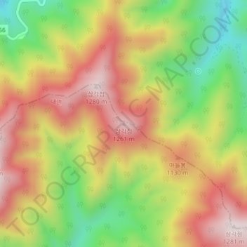
Name: 1261 topographic map, elevation, terrain.
Location: 1261, 양양군, Gangwon, Coreia do Sul (37.88680 128.54444 37.88690 128.54454)
Average elevation: 990 m
Minimum elevation: 685 m
Maximum elevation: 1,263 m
Other topographic maps
Click on a map to view its topography, its elevation and its terrain.