
Nauen topographic map
Interactive map
Click on the map to display elevation.
About this map
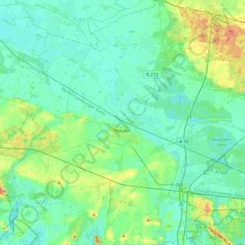
Name: Nauen topographic map, elevation, terrain.
Location: Nauen, Havelland, Brandenburg, 14641, Germany (52.49947 12.65240 52.72538 13.01349)
Average elevation: 36 m
Minimum elevation: 27 m
Maximum elevation: 69 m
Other topographic maps
Click on a map to view its topography, its elevation and its terrain.