
دقة topographic map
Interactive map
Click on the map to display elevation.
About this map
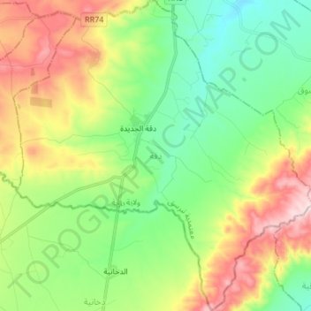
Name: دقة topographic map, elevation, terrain.
Location: دقة, معتمدية تبرسق, Béja, Tunisia (36.33545 9.18370 36.44415 9.31530)
Average elevation: 445 m
Minimum elevation: 278 m
Maximum elevation: 738 m
Other topographic maps
Click on a map to view its topography, its elevation and its terrain.