
Lonorore topographic map
Interactive map
Click on the map to display elevation.
About this map
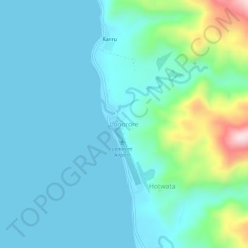
Name: Lonorore topographic map, elevation, terrain.
Location: Lonorore, Penama, Vanuatu (-15.88103 168.15138 -15.84103 168.19138)
Average elevation: 69 m
Minimum elevation: 0 m
Maximum elevation: 400 m
Other topographic maps
Click on a map to view its topography, its elevation and its terrain.
Ambae
Traditional subsistence agriculture satisfies food needs, while most villagers engage in small-scale cash crop production as well. Often grown in large upland gardens (with good rainfall and safe from roving pigs), the primary crops are taro, banana, yam, and manioc. Kumala (sweet potatoes – a good tuber…
Average elevation: 175 m