
Woose Hill topographic map
Interactive map
Click on the map to display elevation.
About this map
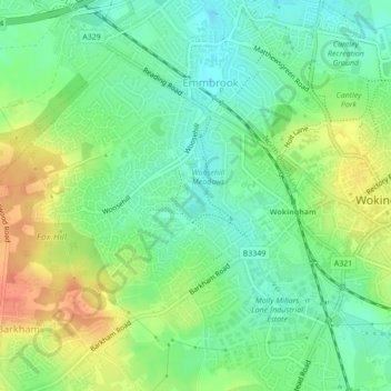
Name: Woose Hill topographic map, elevation, terrain.
Average elevation: 60 m
Minimum elevation: 41 m
Maximum elevation: 88 m
Other topographic maps
Click on a map to view its topography, its elevation and its terrain.
Wokingham
United Kingdom > England > Wokingham
Wokingham, South East, England, RG40 1TG, United Kingdom
Average elevation: 61 m