
Régina topographic map
Interactive map
Click on the map to display elevation.
About this map
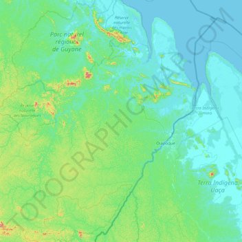
Name: Régina topographic map, elevation, terrain.
Location: Régina, Arrondissement de Cayenne, Guyane, 97390, France (3.18874 -53.23319 4.78907 -51.75012)
Average elevation: 63 m
Minimum elevation: -3 m
Maximum elevation: 654 m
Other topographic maps
Click on a map to view its topography, its elevation and its terrain.
Camp Saut-Pararé
Camp Saut-Pararé, Régina, Saint-Georges, Guyane, France
Average elevation: 70 m
Mont Cépérou
Mont Cépérou, Cayenne, Arrondissement de Cayenne, Guyane, 97300, France
Average elevation: 2 m
Montsinéry
France > Guyane > Montsinéry-Tonnegrande > Montsinéry
Montsinéry, Montsinéry-Tonnegrande, Cayenne, Guyane, 97356, France
Average elevation: 7 m
Remire-Montjoly
Remire-Montjoly, Cayenne, Guyane, 97354, France
Average elevation: 18 m