Geolocate

Samu topographic map

Click on the map to display elevation.

About this map

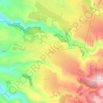
Name: Samu topographic map, elevation, terrain.

Location: Samu, Koorah Sub-District, Koorah District, Irbid, Jordan (32.49667 35.71722 32.53667 35.75722)

Average elevation: 437 m

Minimum elevation: 237 m

Maximum elevation: 625 m

Other topographic maps

Click on a map to view its topography, its elevation and its terrain.

Gear up for your next adventure:

🛰️Satellite Messengers - Emergency communication devices for areas without mobile signal
🔥Reusable Hand Warmers - Maintain dexterity in your fingers for precise map handling
🔋Lithium AA Batteries - Long-lasting power that performs well in cold mountain weather
🕶️Glacier Goggles - Maximum protection for high-altitude snow topography
🥤Collapsible Water Bottles - Save space in your rucksack as you consume your water

As an Amazon Associate, this site earns from qualifying purchases at no extra cost to you.