
Oued Zenati topographic map
Interactive map
Click on the map to display elevation.
About this map
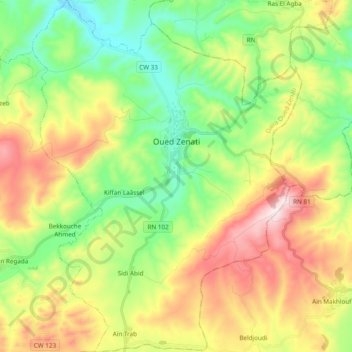
Name: Oued Zenati topographic map, elevation, terrain.
Location: Oued Zenati, Oued Zenati District, Guelma, 24300, Algeria (36.22041 7.08597 36.37504 7.23270)
Average elevation: 791 m
Minimum elevation: 563 m
Maximum elevation: 1,145 m
Other topographic maps
Click on a map to view its topography, its elevation and its terrain.
Bordj Sabat
Algeria > Guelma > Oued Zenati District > Bordj Sabat > Bordj Sabat
Bordj Sabat, Oued Zenati District, Guelma, Algeria
Average elevation: 665 m