
Kasanje topographic map
Interactive map
Click on the map to display elevation.
About this map
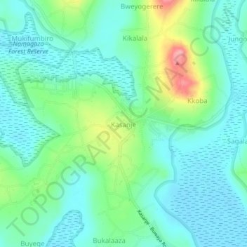
Name: Kasanje topographic map, elevation, terrain.
Location: Kasanje, Entebbe City, Wakiso, Central Region, Uganda (0.13278 32.37812 0.17278 32.41812)
Average elevation: 1,162 m
Minimum elevation: 1,134 m
Maximum elevation: 1,244 m
Other topographic maps
Click on a map to view its topography, its elevation and its terrain.