
Buswa topographic map
Interactive map
Click on the map to display elevation.
About this map
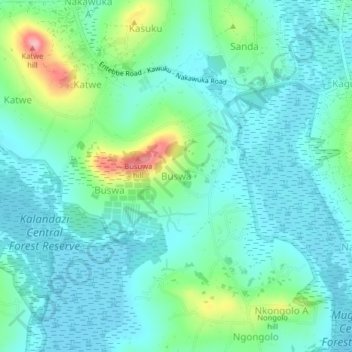
Name: Buswa topographic map, elevation, terrain.
Location: Buswa, Entebbe City, Wakiso, Central Region, Uganda (0.14825 32.45427 0.18825 32.49427)
Average elevation: 1,165 m
Minimum elevation: 1,133 m
Maximum elevation: 1,278 m
Other topographic maps
Click on a map to view its topography, its elevation and its terrain.
Kasanje
Uganda > Wakiso > Entebbe City
Kasanje, Entebbe City, Wakiso, Central Region, Uganda
Average elevation: 1,162 m
Nakawuka
Uganda > Wakiso > Entebbe City
Nakawuka, Entebbe City, Wakiso, Central Region, Uganda
Average elevation: 1,182 m
Abaita Babiri
Uganda > Wakiso > Entebbe City
Abaita Babiri, Nkumba, Entebbe City, Wakiso, Central Region, Uganda
Average elevation: 1,154 m