

Azzaba topographic map
Click on the map to display elevation.
About this map
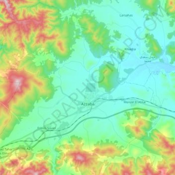
Name: Azzaba topographic map, elevation, terrain.
Location: Azzaba, Azzaba District, Skikda, Algeria (36.67740 6.99444 36.82875 7.18840)
Average elevation: 174 m
Minimum elevation: 44 m
Maximum elevation: 525 m
Other topographic maps
Click on a map to view its topography, its elevation and its terrain.
Menzel El Abtal
Algeria > Skikda > Azzaba District > Azzaba > Menzel El Abtal
Average elevation: 104 m