
Thank you for supporting this site ❤️
Make a donation
Make a donation
Gear up for your next adventure:
As an Amazon Associate, this site earns from qualifying purchases at no extra cost to you.
青海湖 topographic map
Click on the map to display elevation.
Thank you for supporting this site ❤️
Make a donation
Make a donation
Gear up for your next adventure:
As an Amazon Associate, this site earns from qualifying purchases at no extra cost to you.
About this map
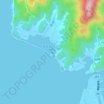
Name: 青海湖 topographic map, elevation, terrain.
Location: 青海湖, Nagato, Yamaguchi Prefecture, Japan (34.40208 131.18398 34.40537 131.18640)
Average elevation: 31 m
Minimum elevation: -2 m
Maximum elevation: 258 m
Thank you for supporting this site ❤️
Make a donation
Make a donation
Gear up for your next adventure:
As an Amazon Associate, this site earns from qualifying purchases at no extra cost to you.