Geolocate

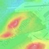
Lawn topographic map

Click on the map to display elevation.

About this map

Name: Lawn topographic map, elevation, terrain.

Location: Lawn, Newfoundland, Newfoundland and Labrador, A0E 2E0, Canada (46.91592 -55.55189 46.95489 -55.52695)

Average elevation: 62 m

Minimum elevation: -3 m

Maximum elevation: 176 m

Other topographic maps

Click on a map to view its topography, its elevation and its terrain.
Botwood

Canada > Newfoundland and Labrador > Botwood

Average elevation: 17 m

LaScie

Canada > Newfoundland and Labrador

Average elevation: 98 m

Spot Pond

Canada > Newfoundland and Labrador

Average elevation: 118 m

The Peak

Canada > Newfoundland and Labrador

Average elevation: 67 m

Roundabout

Canada > Newfoundland and Labrador

Average elevation: 65 m

White Horse

Canada > Newfoundland and Labrador

Average elevation: 99 m

The Cabox

Canada > Newfoundland and Labrador

Average elevation: 698 m

Gear up for your next adventure:

🧤Waterproof Overmitts - Extreme weather protection for hikers and mountaineers
🧺Mesh Stuff Sacks - Breathable storage for wet gear or camp organization
🔭Compact Hiking Binoculars - Lightweight optics for scouting terrain and spotting wildlife
🔋Lithium AA Batteries - Long-lasting power that performs well in cold mountain weather
🧣Neck Gaiters - Versatile protection against wind and cold

As an Amazon Associate, this site earns from qualifying purchases at no extra cost to you.