
Aesch (ZH) topographic map
Interactive map
Click on the map to display elevation.
About this map
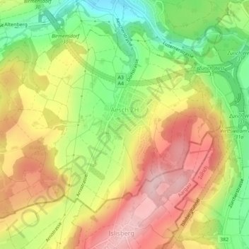
Name: Aesch (ZH) topographic map, elevation, terrain.
Location: Aesch (ZH), Bezirk Dietikon, Zürich, 8904, Schweiz (47.32447 8.41241 47.34668 8.45523)
Average elevation: 580 m
Minimum elevation: 472 m
Maximum elevation: 681 m
Other topographic maps
Click on a map to view its topography, its elevation and its terrain.
Schlieren
Schweiz > Zürich > Bezirk Dietikon
Schlieren, Bezirk Dietikon, Zürich, 8952, Schweiz
Average elevation: 440 m
Ringlikon
Schweiz > Zürich > Bezirk Dietikon > Waldegg
Ringlikon, Waldegg, Uitikon, Bezirk Dietikon, Zürich, 8142, Schweiz
Average elevation: 575 m