Geolocate

Gwernaffield topographic map

Click on the map to display elevation.

About this map

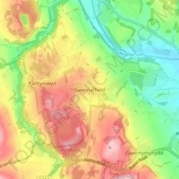
Name: Gwernaffield topographic map, elevation, terrain.

Location: Gwernaffield, Flintshire, Wales, CH7 5DS, United Kingdom (53.15106 -3.20896 53.19106 -3.16896)

Average elevation: 192 m

Minimum elevation: 108 m

Maximum elevation: 284 m

Flintshire trails, hiking, mountain biking, running and outdoor activities

Other topographic maps

Click on a map to view its topography, its elevation and its terrain.

Ewloe Castle

United Kingdom > Wales > Flintshire > Ewloe

Average elevation: 74 m

Penyffordd

United Kingdom > Wales > Flintshire

Average elevation: 101 m

Bagilt Reservior

United Kingdom > Wales > Flintshire > Bagillt

Average elevation: 32 m

Wepre Park

United Kingdom > Wales > Flintshire > Connah's Quay

Average elevation: 46 m

Saltney

United Kingdom > Wales > Flintshire

Average elevation: 9 m

Point of Ayr

United Kingdom > Wales > Flintshire > Talacre

Average elevation: 2 m

Nannerch

United Kingdom > Wales > Flintshire > Nannerch

Average elevation: 232 m

Gear up for your next adventure:

🥫Expedition Meals - Lightweight, high-calorie nutrition for long-distance hikers
👟Heavy Duty Boot Laces - Always carry a spare for your hiking footwear
📷Outdoor Action Cameras - Cameras designed for hiking and adventure
🧦Merino Wool Hiking Socks - Moisture-wicking socks to prevent blisters during long mountain walks
🔦Keychain LED Torches - Emergency backup light for finding gear in your pack

As an Amazon Associate, this site earns from qualifying purchases at no extra cost to you.