
Thank you for supporting this site ❤️
Make a donation
Make a donation
Gear up for your next adventure:
As an Amazon Associate, this site earns from qualifying purchases at no extra cost to you.
Milde topographic map
Click on the map to display elevation.
Thank you for supporting this site ❤️
Make a donation
Make a donation
Gear up for your next adventure:
As an Amazon Associate, this site earns from qualifying purchases at no extra cost to you.
About this map
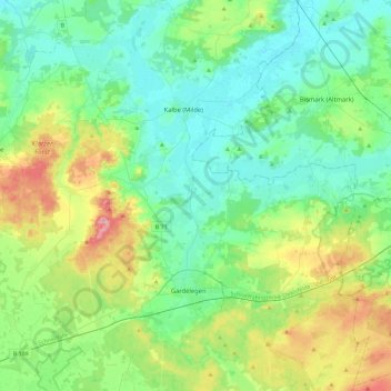
Name: Milde topographic map, elevation, terrain.
Location: Milde, Altmarkkreis Salzwedel, Saxony-Anhalt, Germany (52.45492 11.36442 52.73376 11.52359)
Average elevation: 59 m
Minimum elevation: 27 m
Maximum elevation: 152 m
Thank you for supporting this site ❤️
Make a donation
Make a donation
Gear up for your next adventure:
As an Amazon Associate, this site earns from qualifying purchases at no extra cost to you.