
Megchelen topographic map
Interactive map
Click on the map to display elevation.
About this map
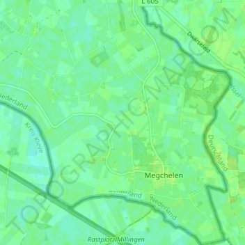
Name: Megchelen topographic map, elevation, terrain.
Location: Megchelen, Oude IJsselstreek, Gelderland, Nederland (51.82726 6.34869 51.86564 6.40917)
Average elevation: 16 m
Minimum elevation: 11 m
Maximum elevation: 20 m
Other topographic maps
Click on a map to view its topography, its elevation and its terrain.
Breedenbroek
Nederland > Gelderland > Oude IJsselstreek
Breedenbroek, Oude IJsselstreek, Gelderland, Nederland
Average elevation: 18 m
Gendringen
Nederland > Gelderland > Oude IJsselstreek > Gendringen
Gendringen, Oude IJsselstreek, Gelderland, Nederland, 7081, Nederland
Average elevation: 16 m