Geolocate

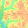
Hague topographic map

Click on the map to display elevation.

About this map

Name: Hague topographic map, elevation, terrain.

Location: Hague, Westmoreland County, Virginia, 22469, United States (38.05236 -76.67107 38.09236 -76.63107)

Average elevation: 23 m

Minimum elevation: 1 m

Maximum elevation: 52 m

Other topographic maps

Click on a map to view its topography, its elevation and its terrain.

Montross

United States > Virginia > Westmoreland County

Average elevation: 37 m

Gear up for your next adventure:

📷Outdoor Action Cameras - Cameras designed for hiking and adventure
🎒Multi-day Trekking Packs - Large capacity backpacks for wild camping and long-distance trails
📐Altimeters & Barometers - Tools for measuring altitude and air pressure
🧤Waterproof Overmitts - Extreme weather protection for hikers and mountaineers
🎒Hiking Daypacks - Compact backpacks ideal for short hikes and excursions

As an Amazon Associate, this site earns from qualifying purchases at no extra cost to you.