
Jagat topographic map
Interactive map
Click on the map to display elevation.
About this map
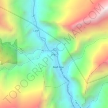
Name: Jagat topographic map, elevation, terrain.
Location: Jagat, Chum Nubri, Gorkha, Gandaki Province, Nepal (28.33141 84.87586 28.37141 84.91586)
Average elevation: 1,986 m
Minimum elevation: 1,272 m
Maximum elevation: 3,138 m
Other topographic maps
Click on a map to view its topography, its elevation and its terrain.