
Pârcălabul topographic map
Interactive map
Click on the map to display elevation.
About this map
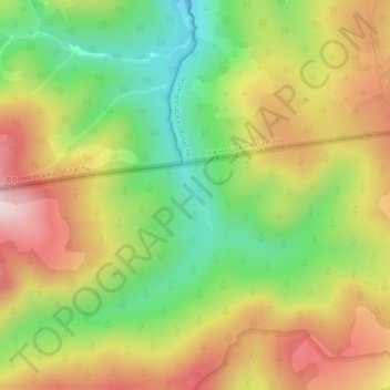
Name: Pârcălabul topographic map, elevation, terrain.
Location: Pârcălabul, Borșa, Maramureș, Romania (47.72241 24.92234 47.72674 24.92538)
Average elevation: 1,343 m
Minimum elevation: 1,140 m
Maximum elevation: 1,564 m
Other topographic maps
Click on a map to view its topography, its elevation and its terrain.