
Prince Charles Island topographic map
Interactive map
Click on the map to display elevation.
About this map
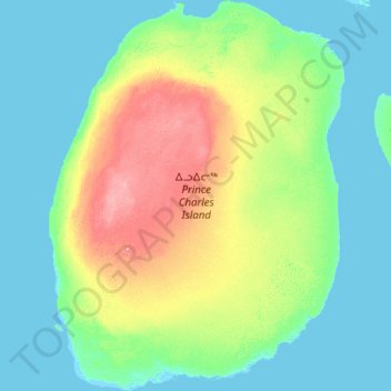
Name: Prince Charles Island topographic map, elevation, terrain.
Location: Prince Charles Island, Nunavut, Kanada (67.20600 -77.28506 68.34595 -75.00334)
Average elevation: 17 m
Minimum elevation: -3 m
Maximum elevation: 100 m
Other topographic maps
Click on a map to view its topography, its elevation and its terrain.