
Ruhstorf topographic map
Interactive map
Click on the map to display elevation.
About this map
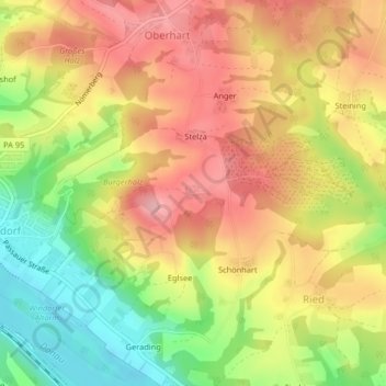
Name: Ruhstorf topographic map, elevation, terrain.
Location: Ruhstorf, Windorf, Landkreis Passau, Bayern, Deutschland (48.62581 13.24427 48.62697 13.24685)
Average elevation: 376 m
Minimum elevation: 297 m
Maximum elevation: 439 m
Other topographic maps
Click on a map to view its topography, its elevation and its terrain.
Vordergalgenberg
Deutschland > Bayern > Landkreis Passau > Windorf
Vordergalgenberg, Windorf, Landkreis Passau, Bayern, Deutschland
Average elevation: 460 m