
Assateague Island National Seashore topographic map
Interactive map
Click on the map to display elevation.
About this map
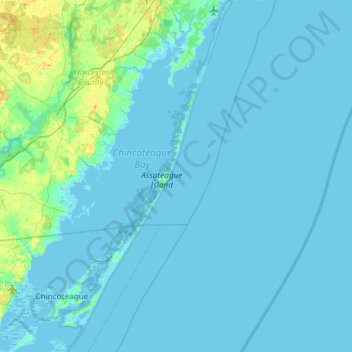
Name: Assateague Island National Seashore topographic map, elevation, terrain.
Average elevation: 2 m
Minimum elevation: -4 m
Maximum elevation: 21 m
Other topographic maps
Click on a map to view its topography, its elevation and its terrain.
West Ocean City
United States > Maryland > Worcester County > West Ocean City
West Ocean City, Worcester County, Maryland, United States
Average elevation: 2 m