
Pêra do Moço topographic map
Interactive map
Click on the map to display elevation.
About this map
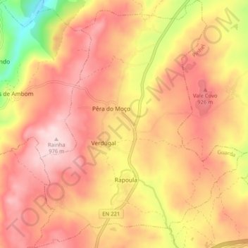
Name: Pêra do Moço topographic map, elevation, terrain.
Location: Pêra do Moço, Guarda, Portugal (40.57915 -7.23640 40.63947 -7.16920)
Average elevation: 844 m
Minimum elevation: 628 m
Maximum elevation: 971 m
Other topographic maps
Click on a map to view its topography, its elevation and its terrain.