
Mỹ Hào District topographic map
Interactive map
Click on the map to display elevation.
About this map
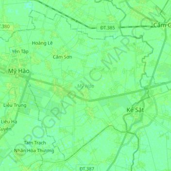
Name: Mỹ Hào District topographic map, elevation, terrain.
Location: Mỹ Hào District, Hưng Yên Province, 03213, Vietnam (20.87325 106.03150 20.97781 106.15820)
Average elevation: 5 m
Minimum elevation: 0 m
Maximum elevation: 7 m
Other topographic maps
Click on a map to view its topography, its elevation and its terrain.
Hung Yen City
Hung Yen City, Hưng Yên Province, Vietnam
Average elevation: 5 m