
Thank you for supporting this site ❤️
Make a donation
Make a donation
Gear up for your next adventure:
As an Amazon Associate, this site earns from qualifying purchases at no extra cost to you.
Chablekal topographic map
Click on the map to display elevation.
Thank you for supporting this site ❤️
Make a donation
Make a donation
Gear up for your next adventure:
As an Amazon Associate, this site earns from qualifying purchases at no extra cost to you.
About this map
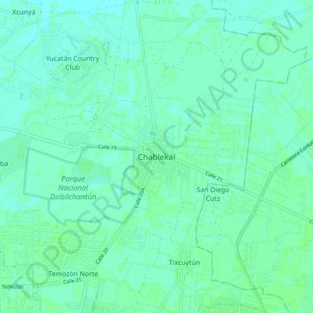
Name: Chablekal topographic map, elevation, terrain.
Location: Chablekal, Mérida, Yucatán, 97500, México (21.05569 -89.61720 21.13569 -89.53720)
Average elevation: 7 m
Minimum elevation: 4 m
Maximum elevation: 10 m
Thank you for supporting this site ❤️
Make a donation
Make a donation
Gear up for your next adventure:
As an Amazon Associate, this site earns from qualifying purchases at no extra cost to you.
Other topographic maps
Click on a map to view its topography, its elevation and its terrain.
Parque Paraiso Maya (GoRaids Altabrisa Norte)
México > Yucatán > Mérida > Mérida
Average elevation: 9 m