
Aliakmonas topographic map
Interactive map
Click on the map to display elevation.
About this map
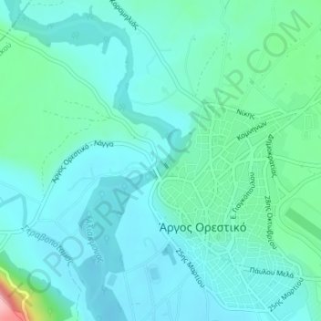
Name: Aliakmonas topographic map, elevation, terrain.
Average elevation: 642 m
Minimum elevation: 614 m
Maximum elevation: 779 m
Other topographic maps
Click on a map to view its topography, its elevation and its terrain.
Region Westmakedonien
Griechenland > Epirus - Westmakedonien
Region Westmakedonien, Epirus - Westmakedonien, Griechenland
Average elevation: 938 m
Epirus - Westmakedonien
Griechenland > Epirus - Westmakedonien
Epirus - Westmakedonien, Griechenland
Average elevation: 661 m