
Rukarara topographic map
Interactive map
Click on the map to display elevation.
Rukarara
The Rukarara rises in forested country in southern Rwanda to the east of the Congo-Nile Divide. The Kamiranzovu Swamp in the Nyungwe Forest Reserve provides a natural reservoir for the Rukarara. The source of the Rukarara is now known to be the overall source of the Nile. This was confirmed by a 2005/2006 expedition up the river with modern navigation equipment. The origin of the Nile, the furthest source from its mouth, is at an elevation of 7,966 feet (2,428 m), at latitude and longitude 2°16′055.962″S 29°19′052.470″E / 2.28221167°S 29.33124167°E / -2.28221167; 29.33124167.
About this map
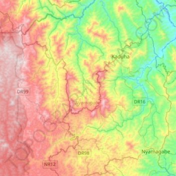
Name: Rukarara topographic map, elevation, terrain.
Location: Rukarara, Nyamagabe, Southern Province, Rwanda (-2.46087 29.35301 -2.29447 29.61569)
Average elevation: 2,022 m
Minimum elevation: 1,520 m
Maximum elevation: 2,628 m
Other topographic maps
Click on a map to view its topography, its elevation and its terrain.