
Old Romney topographic map
Interactive map
Click on the map to display elevation.
About this map
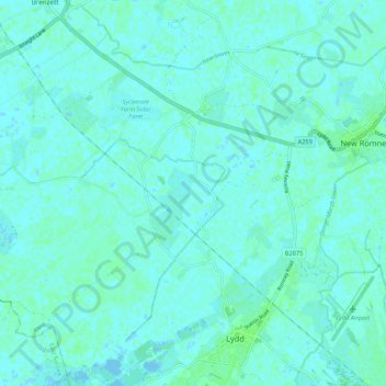
Name: Old Romney topographic map, elevation, terrain.
Average elevation: 2 m
Minimum elevation: -3 m
Maximum elevation: 6 m
Kent trails, hiking, mountain biking, running and outdoor activities
Other topographic maps
Click on a map to view its topography, its elevation and its terrain.
Greatstone beach
United Kingdom > England > Kent > Folkestone and Hythe District > New Romney > Littlestone on Sea
Average elevation: 2 m
Park Gate
United Kingdom > England > Kent > Folkestone and Hythe District > Elham
Average elevation: 130 m
Sandling
United Kingdom > England > Kent > Folkestone and Hythe District > Saltwood
Average elevation: 77 m
Ottinge
United Kingdom > England > Kent > Folkestone and Hythe District > Elham
Average elevation: 133 m
Rhodes Minnis
United Kingdom > England > Kent > Folkestone and Hythe District
Average elevation: 144 m