
Emir Abdelkader topographic map
Interactive map
Click on the map to display elevation.
About this map
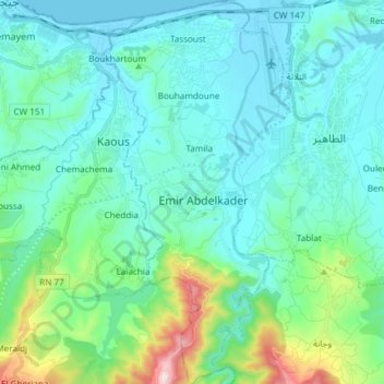
Name: Emir Abdelkader topographic map, elevation, terrain.
Location: Emir Abdelkader, Taher District, Jijel, 18038, Algeria (36.69466 5.80942 36.81408 5.88555)
Average elevation: 126 m
Minimum elevation: -1 m
Maximum elevation: 750 m
Other topographic maps
Click on a map to view its topography, its elevation and its terrain.
Tassoust
Algeria > Jijel > Taher District > Emir Abdelkader > Tassoust
Tassoust, Emir Abdelkader, Taher District, Jijel, 18038, Algeria
Average elevation: 23 m