
Silvela topographic map
Interactive map
Click on the map to display elevation.
About this map
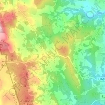
Name: Silvela topographic map, elevation, terrain.
Location: Silvela, Friol, Lugo, Galiza, Espanha (43.01821 -7.93123 43.05506 -7.86947)
Average elevation: 646 m
Minimum elevation: 542 m
Maximum elevation: 798 m
Other topographic maps
Click on a map to view its topography, its elevation and its terrain.