
Make a donation
Gear up for your next adventure:
As an Amazon Associate, this site earns from qualifying purchases at no extra cost to you.
Tyre topographic map
Click on the map to display elevation.
Make a donation
Gear up for your next adventure:
As an Amazon Associate, this site earns from qualifying purchases at no extra cost to you.
Tyre
Since 2008, a Lebanese-French team under the direction by Pierre-Louis Gatier of the University of Lyon has been conducting archaeological and topographical work. When international archeological missions in Syria came to a halt after 2012 due to the war there, some of them instead started excavations in Tyre, amongst them a team headed by Leila Badre, director of the Archeological Museum of the American University of Beirut (AUB), and Belgian archaeologists.
Make a donation
Gear up for your next adventure:
As an Amazon Associate, this site earns from qualifying purchases at no extra cost to you.
About this map
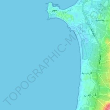
Name: Tyre topographic map, elevation, terrain.
Location: Tyre, Tyre District, South Governorate, 1601, Lebanon (33.21991 35.19059 33.27719 35.22981)
Average elevation: 5 m
Minimum elevation: -3 m
Maximum elevation: 79 m
Make a donation
Gear up for your next adventure:
As an Amazon Associate, this site earns from qualifying purchases at no extra cost to you.
Other topographic maps
Click on a map to view its topography, its elevation and its terrain.
Make a donation
Gear up for your next adventure:
As an Amazon Associate, this site earns from qualifying purchases at no extra cost to you.
Make a donation
Gear up for your next adventure:
As an Amazon Associate, this site earns from qualifying purchases at no extra cost to you.
Make a donation
Gear up for your next adventure:
As an Amazon Associate, this site earns from qualifying purchases at no extra cost to you.
Make a donation
Gear up for your next adventure:
As an Amazon Associate, this site earns from qualifying purchases at no extra cost to you.
Kafr Bayt
Kfar Beit (also known as كفر بيت, Kfar Beït, Kafr Bayt or Kfarbeet) is a Lebanese village in the south of Lebanon. It is close to the city of Saida. Kfar Beit has an average elevation of 374 meters or 1,227 feet.
Average elevation: 371 m
Make a donation
Gear up for your next adventure:
As an Amazon Associate, this site earns from qualifying purchases at no extra cost to you.
Jarmaq
Jarmaq (جرمق) is a village in the Jezzine District in southern Lebanon, located 82 kilometers (51 mi) southeast of the capital Beirut. It is situated at the lower, western ridge of Mount Meron, overlooking the Sea of Galilee. It has an altitude of 390 meters (1,280 ft). Its land area is 448 hectares.
Average elevation: 489 m
Sidon
The city of Sidon is administrated by the Municipality of Sidon. The municipality is constituted of a council of 21 members including the City Mayor and his Deputy. It has administrative and financial independence but remains under the control and supervision of the central government, specifically the…
Average elevation: 230 m
Jezzine
Jezzine (Arabic: جزين Jizzīn) is a town in Lebanon, located 22 km (14 mi) from Sidon and 40 km (25 mi) south of Beirut. It is the capital of Jezzine District. Surrounded by mountain peaks, pine forests (like the Bkassine Pine Forest), and at an average altitude of 950 m (3,117 ft), it is the main summer…
Average elevation: 1,072 m
Make a donation
Gear up for your next adventure:
As an Amazon Associate, this site earns from qualifying purchases at no extra cost to you.
Make a donation
Gear up for your next adventure:
As an Amazon Associate, this site earns from qualifying purchases at no extra cost to you.