
Ghurian topographic map
Interactive map
Click on the map to display elevation.
About this map
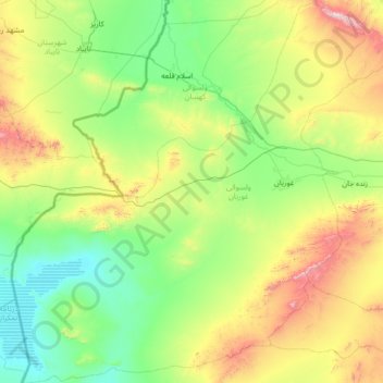
Name: Ghurian topographic map, elevation, terrain.
Location: Ghurian, Herat Province, Afghanistan (33.74852 60.51760 34.88025 61.78593)
Average elevation: 929 m
Minimum elevation: 592 m
Maximum elevation: 2,063 m
Other topographic maps
Click on a map to view its topography, its elevation and its terrain.
Gaza
Afghanistan > Herat Province > Ghurian > Gaza
Gaza, Ghurian, Herat Province, Afghanistan
Average elevation: 786 m