Geolocate

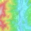
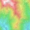
Rimella topographic map

Click on the map to display elevation.

About this map

Name: Rimella topographic map, elevation, terrain.

Location: Rimella, Vercelli, Piedmont, Italy (45.88930 8.14708 45.95076 8.23885)

Average elevation: 1,585 m

Minimum elevation: 851 m

Maximum elevation: 2,400 m

Other topographic maps

Click on a map to view its topography, its elevation and its terrain.

Alpe Tele di Sotto

Italy > Piedmont > Vercelli > Cervatto

Average elevation: 1,541 m

Foresto

Italy > Piedmont > Vercelli > Borgosesia

Average elevation: 647 m

Sasso Lungo

Italy > Piedmont > Vercelli > Scopa > Otra

Average elevation: 854 m

Ruse

Italy > Piedmont > Vercelli > Varallo > I Prati

Average elevation: 787 m

Fontana dello Zolfo

Italy > Piedmont > Vercelli > Trino

Average elevation: 149 m

San Giuseppe

Italy > Piedmont > Vercelli

Average elevation: 1,618 m

Sn2

Italy > Piedmont > Vercelli > Boccioleto

Average elevation: 1,290 m

Le Castelle

Italy > Piedmont > Vercelli > Gattinara

Average elevation: 314 m

Gear up for your next adventure:

🎒Hiking Child Carriers - Explore the outdoors with the whole family safely
🚲Cycling GPS Computers - Track elevation and topographic routes on two wheels
👟Heavy Duty Boot Laces - Always carry a spare for your hiking footwear
🔋Solar Power Banks - Keep your GPS and phone charged during multi-day expeditions
🛌Sleeping Bags - Warm and packable sleeping bags for outdoor nights

As an Amazon Associate, this site earns from qualifying purchases at no extra cost to you.