Geolocate

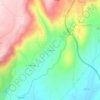
Palhais topographic map

Click on the map to display elevation.

About this map
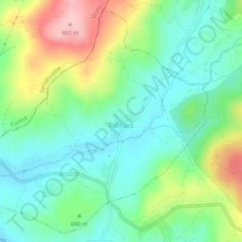
Name: Palhais topographic map, elevation, terrain.

Location: Palhais, Trancoso, Guarda, 6420-522, Portugal (40.80377 -7.45477 40.82907 -7.41869)

Average elevation: 677 m

Minimum elevation: 619 m

Maximum elevation: 794 m

Other topographic maps

Click on a map to view its topography, its elevation and its terrain.
Vila Franca das Naves

Portugal > Guarda > Trancoso

Average elevation: 598 m

Freches

Portugal > Guarda > Trancoso

Average elevation: 588 m

Corças

Portugal > Guarda > Trancoso

Average elevation: 825 m

Castaíde

Portugal > Guarda > Trancoso

Average elevation: 807 m

Ribeira do Freixo

Portugal > Guarda > Trancoso

Average elevation: 629 m

Esporões

Portugal > Guarda > Trancoso > Moreira de Rei

Average elevation: 723 m

Golfar

Portugal > Guarda > Trancoso > Moreira de Rei

Average elevation: 762 m

Gear up for your next adventure:

🍱Food Containers - Reusable containers for outdoor meals
🔋Solar Chargers - Eco-friendly charging solutions for outdoor use
🔦Keychain LED Torches - Emergency backup light for finding gear in your pack
🧗Locking Carabiners - Secure gear to your pack or for light technical use
🩹Hiking First Aid Kits - Compact medical kits tailored for trail injuries and emergencies

As an Amazon Associate, this site earns from qualifying purchases at no extra cost to you.