Geolocate

Devine topographic map

Click on the map to display elevation.

About this map

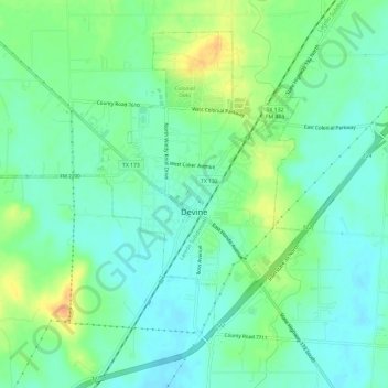
Name: Devine topographic map, elevation, terrain.

Location: Devine, Medina County, Texas, 78016, United States (29.12038 -98.94366 29.16427 -98.88385)

Average elevation: 204 m

Minimum elevation: 191 m

Maximum elevation: 230 m

Other topographic maps

Click on a map to view its topography, its elevation and its terrain.

Mico

United States > Texas > Medina County

Average elevation: 334 m

D'Hanis

United States > Texas > Medina County

D'Hanis is at an elevation of 883 feet (269 m) above sea level.

Average elevation: 273 m

Castroville

United States > Texas > Medina County

Average elevation: 249 m

Coal Mine

United States > Texas > Medina County > Lytle

Average elevation: 226 m

Noonan

United States > Texas > Medina County

Average elevation: 247 m

Gear up for your next adventure:

🥄Titanium Camping Sporks - The ultimate lightweight utensil for trail meals
🖼️Topographic Map Art - Decorative 3D-effect posters of famous UK peaks and regions
🐕Dog Hiking Gear - Equipment for hiking safely with dogs
🥾Men's Waterproof Hiking Boots - Durable footwear with deep lugs for muddy and rocky UK terrains
GPS Outdoor Watches - Watches with GPS tracking for hiking and exploration

As an Amazon Associate, this site earns from qualifying purchases at no extra cost to you.