
Aathrai topographic map
Interactive map
Click on the map to display elevation.
About this map
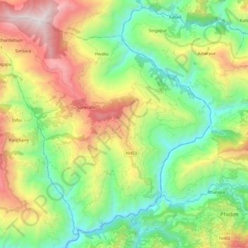
Name: Aathrai topographic map, elevation, terrain.
Location: Aathrai, Tehrathum, Koshi Province, Nepal (27.12925 87.55280 27.28718 87.75151)
Average elevation: 1,186 m
Minimum elevation: 389 m
Maximum elevation: 2,619 m
Other topographic maps
Click on a map to view its topography, its elevation and its terrain.