
Chami topographic map
Interactive map
Click on the map to display elevation.
About this map
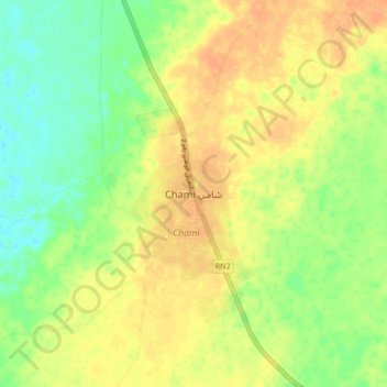
Name: Chami topographic map, elevation, terrain.
Location: Chami, Dakhlet Nouadhibou, Mauritania (20.12728 -16.01233 20.20728 -15.93233)
Average elevation: 33 m
Minimum elevation: 14 m
Maximum elevation: 48 m
Other topographic maps
Click on a map to view its topography, its elevation and its terrain.