
Mukkoottuthara topographic map
Interactive map
Click on the map to display elevation.
About this map
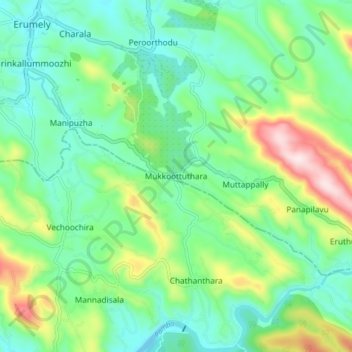
Name: Mukkoottuthara topographic map, elevation, terrain.
Location: Mukkoottuthara, Kanjirappally, Kottayam, Kerala, 686510, India (9.40675 76.83813 9.48675 76.91813)
Average elevation: 159 m
Minimum elevation: 36 m
Maximum elevation: 468 m
Other topographic maps
Click on a map to view its topography, its elevation and its terrain.
Ponkunnam
India > Kerala > Kanjirappally
Ponkunnam is a census town in Kerala, India, part of Kottayam district under Kanjirappally taluk. Ponkunnam literally means golden mountain (ponn = gold, kunn = mountain). Nearby towns are Kanjirappalli, Pampady , Manimala and Pala. This part of Kerala is famous for its fertile land and rubber plantations. It…
Average elevation: 83 m