Geolocate

Naka Ward topographic map

Click on the map to display elevation.

About this map

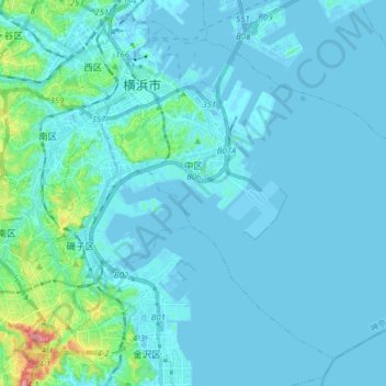
Name: Naka Ward topographic map, elevation, terrain.

Location: Naka Ward, Yokohama, Kanagawa Prefecture, 231-0017, Japan (35.35403 139.62167 35.46296 139.77693)

Average elevation: 13 m

Minimum elevation: -10 m

Maximum elevation: 149 m

Other topographic maps

Click on a map to view its topography, its elevation and its terrain.

Yokohama

Japan > Yokohama

Average elevation: 22 m

Gear up for your next adventure:

🔦Waterproof LED Headlamps - Hands-free lighting for evening treks and emergency navigation
🧢Waterproof Hiking Hats - Keep the rain off your face while studying topographic maps
👟Heavy Duty Boot Laces - Always carry a spare for your hiking footwear
🛰️Handheld GPS Devices - Reliable GPS units for hiking and outdoor navigation
🌄Outdoor Binoculars - Compact binoculars for landscape observation

As an Amazon Associate, this site earns from qualifying purchases at no extra cost to you.