Geolocate

Person County topographic map

Click on the map to display elevation.

About this map

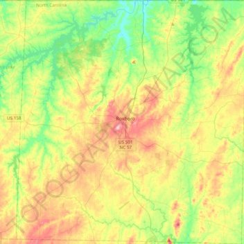
Name: Person County topographic map, elevation, terrain.

Location: Person County, North Carolina, United States (36.23608 -79.15374 36.54215 -78.79483)

Average elevation: 171 m

Minimum elevation: 103 m

Maximum elevation: 270 m

Other topographic maps

Click on a map to view its topography, its elevation and its terrain.

Concord

United States > North Carolina > Person County

Average elevation: 164 m

Gear up for your next adventure:

🚲Cycling GPS Computers - Track elevation and topographic routes on two wheels
📱Rugged Phone Cases - Heavy-duty protection for smartphones used as secondary GPS tools
🧺Ultralight Dry Bags - Organize and waterproof your gear inside your rucksack
Lightweight Tents - Compact tents for backpacking and trekking
🧊Insulated Flasks - Keeps drinks hot or cold during hikes

As an Amazon Associate, this site earns from qualifying purchases at no extra cost to you.