
Rubkona topographic map
Interactive map
Click on the map to display elevation.
About this map
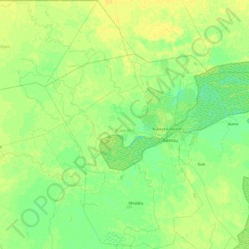
Name: Rubkona topographic map, elevation, terrain.
Location: Rubkona, Unity, South Sudan (8.85827 29.34451 9.75000 29.92028)
Average elevation: 394 m
Minimum elevation: 388 m
Maximum elevation: 400 m
Other topographic maps
Click on a map to view its topography, its elevation and its terrain.