
Limon topographic map
Click on the map to display elevation.
Limon
Limon Municipal Airport is a public use airport located within the Town of Limon on the eastern edge of town. The airport encompasses approximately 397 acres and is owned and operated by the Town of Limon. The airport is a general aviation airport utilized by a range of aircraft ranging from single-engine aircraft up to small sized multi-engine business jets. Limon Municipal Airport is located at 39°16'29.2"N latitude and 103°39'57.1"W longitude. The Airport elevation is 5,374 feet mean sea level (MSL). The current Runway Design Code for Runway 16/34 and ARC for the Limon Municipal Airport is B-I (Small). The current design aircraft for the airport is the Beech King Air 100. There are two runways at Limon Municipal Airport: 16 and 34. They are 4,700 feet long and 60 feet wide. They are constructed of concrete with a published strength sufficient for 12,500 pound aircraft with single wheel gear. The taxiway system at the airport consists of partial parallel taxiway A with connector taxiway A1, A2, and A3. The taxiways are 25 feet wide and are in good condition. The aircraft apron provides an area for based and transient aircraft parking. Limon Municipal Airport has approximately 6,010 square yards of apron with 20 aircraft tie-downs. The airport provides fueling facilities by credit or proprietary cards.
About this map
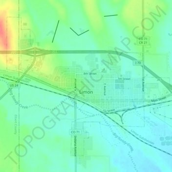
Name: Limon topographic map, elevation, terrain.
Location: Limon, Lincoln County, Colorado, 80828, United States (39.25128 -103.71493 39.28085 -103.66765)
Average elevation: 1,642 m
Minimum elevation: 1,625 m
Maximum elevation: 1,682 m
Other topographic maps
Click on a map to view its topography, its elevation and its terrain.