Geolocate

Lincoln County topographic maps

Click on a map to view its topography, its elevation and its terrain.
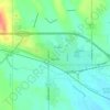
Limon

United States > Colorado > Lincoln County

Limon is located at 39°15′50″N 103°41′32″W / 39.26389°N 103.69222°W / 39.26389; -103.69222 at an elevation of 5,377 feet (1,639 m). Although entirely in Lincoln County, Limon is located immediately east of the Elbert County line. It lies on the north side of Big Sandy Creek, a tributary of…

Average elevation: 1,639 m

Wareland

United States > Colorado > Lincoln County

Average elevation: 1,624 m

Arriba

United States > Colorado > Lincoln County

Average elevation: 1,596 m

Arriba

United States > Colorado > Lincoln County

Average elevation: 1,597 m

Gear up for your next adventure:

🥾Walking Shoes - Lightweight walking shoes for countryside and coastal paths
🧢Thermal Beanie Hats - Prevent heat loss from the head in windy summit conditions
🦶Anti-Blister Balms - Protect your feet before long topographic expeditions
🌄Outdoor Binoculars - Compact binoculars for landscape observation
👖Packable Overtrousers - Quick-deploy rain protection for legs in sudden storms

As an Amazon Associate, this site earns from qualifying purchases at no extra cost to you.