
Goia topographic map
Interactive map
Click on the map to display elevation.
About this map
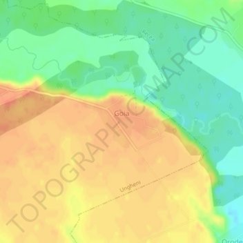
Name: Goia topographic map, elevation, terrain.
Location: Goia, Ungheni, Argeș, 117783, Roménia (44.52120 24.99158 44.52758 25.00810)
Average elevation: 179 m
Minimum elevation: 155 m
Maximum elevation: 199 m
Other topographic maps
Click on a map to view its topography, its elevation and its terrain.