
Janówka Wschodnia topographic map
Interactive map
Click on the map to display elevation.
About this map
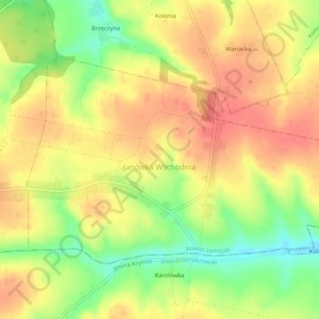
Name: Janówka Wschodnia topographic map, elevation, terrain.
Average elevation: 267 m
Minimum elevation: 226 m
Maximum elevation: 295 m
Other topographic maps
Click on a map to view its topography, its elevation and its terrain.
Kornelówka
Poland > Lublin Voivodeship > Zamość County
Kornelówka, gmina Sitno, Zamość County, Lublin Voivodeship, Poland
Average elevation: 244 m
Krasnobród
Poland > Lublin Voivodeship > Zamość County
Krasnobród, gmina Krasnobród, Zamość County, Lublin Voivodeship, 22-440, Poland
Average elevation: 285 m
Białobrzegi
Poland > Lublin Voivodeship > Zamość County
Białobrzegi, gmina Zamość, Zamość County, Lublin Voivodeship, Poland
Average elevation: 209 m