
Tejpur topographic map
Interactive map
Click on the map to display elevation.
About this map
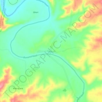
Name: Tejpur topographic map, elevation, terrain.
Average elevation: 324 m
Minimum elevation: 282 m
Maximum elevation: 388 m
Other topographic maps
Click on a map to view its topography, its elevation and its terrain.
Garh
India > Rajasthan > Choti Sarvan Tehsil
Garh, Choti Sarvan Tehsil, Banswara District, Rajasthan, India
Average elevation: 392 m