Geolocate

Aboh-Mbaise topographic map

Interactive map

Click on the map to display elevation.

About this map

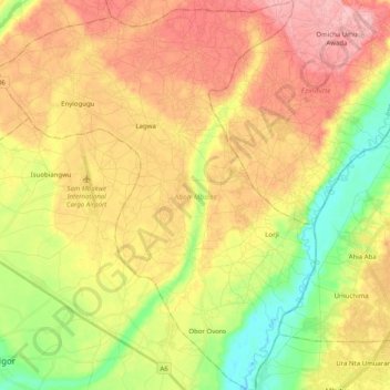
Name: Aboh-Mbaise topographic map, elevation, terrain.

Location: Aboh-Mbaise, Imo State, 462103, Nigeria (5.31960 7.15835 5.51953 7.32265)

Average elevation: 105 m

Minimum elevation: 38 m

Maximum elevation: 167 m

Other topographic maps

Click on a map to view its topography, its elevation and its terrain.

Akabo

Nigeria > Imo State > Mbaitoli

Akabo, Mbaitoli, Imo State, Nigeria

Average elevation: 127 m

Ezinihitte

Nigeria > Imo State

Ezinihitte, Imo State, Nigeria

Average elevation: 115 m

Ahiazu-Mbaise

Nigeria > Imo State

Ahiazu-Mbaise, Imo State, Nigeria

Average elevation: 150 m

Emii

Nigeria > Imo State > Owerri North

Emii, Owerri North, Imo State, Nigeria

Average elevation: 94 m