
Trangan topographic map
Interactive map
Click on the map to display elevation.
About this map
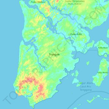
Name: Trangan topographic map, elevation, terrain.
Location: Trangan, Maluku, Indonesia (-6.94442 134.05196 -6.16028 134.53141)
Average elevation: 8 m
Minimum elevation: -4 m
Maximum elevation: 83 m
Other topographic maps
Click on a map to view its topography, its elevation and its terrain.
Batas Desa Dian Pulau Kec Kei Kecil Barat Kabupaten Maluku Tenggara
Indonesia > Maluku > Maluku Tenggara
Average elevation: 6 m